Smart Command & Control for Range Safety
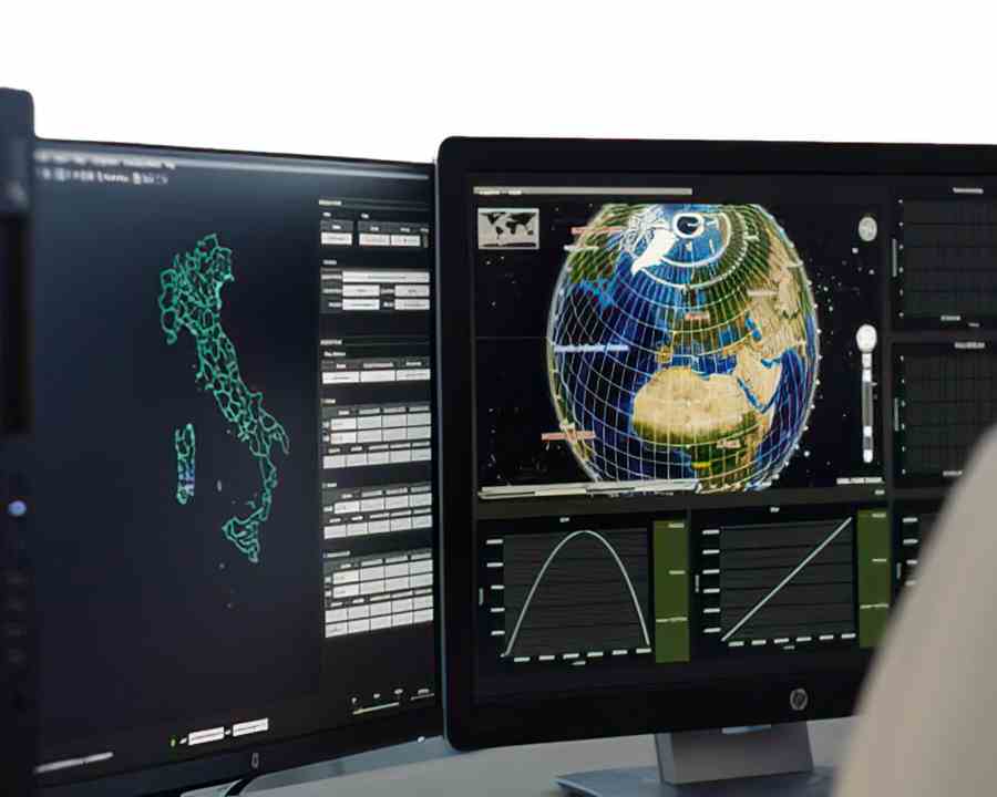
Nurjana Technologies' MSCCS-MMP
Pioneers in Defence Solutions Since 2012:
Building upon decades of experience at the NATO test range of PISQ in Sardinia, Pietro Andronico and Maurizio Cao founded Nurjana Technologies in 2012. A niche organization predominantly serving the defence industry, their enterprise has since flourished. Leveraging employee's core competencies, considerable know-how, and past experience, NurjanaTech now produce solutions to support some of the world’s most crucial infrastructures.
Real-Time Command and Control for Mission Success:
At the core of Nurjana Technologies' success is a nimble, adaptive, and fully-integrated command and control system that produces real-time situational awareness for decision support. The system comprises of two critical components – a Mission Management Platform (MMP) dedicated to real-time data fusion, and a Multi-Sensor Central Control System (MSCCS) designed to seamlessly interface with legacy systems and sensors.
Together, these solutions provide complete, real-time command and control, trajectography, and scenario generation, providing operators with clear, visual data interpretations that allow informed mission decisions. MSCCS-MMP is equally suited to rocket launch as it is for missile test ranges.
Multi-Sensor Central Control System (MSCCS):
The Multi-Sensor Central Control System enables the control and real-time collection of data from multiple "sensors". This data is then processed by the "Multi Sensor Data Fusion Module" of the Mission Management Platform (MMP). Sensors can include, but are not limited to the following and NurjanaTech are open to making bespoke integrations.

Launch Vehicle Telemetry:
The MSCCS will extract longitude, latitude and altitude along with any speed and bearing data from the launch telemetry, IRIG Chapter 10 or other documented format.

Local Radar:
Confirm launch vehicle longitude, latitude and altitude from data extracted from launch site radar system.

Time-Space-Position-Information (TSPI):
Extract Time-Space-Position-Information from one or more Optical Tracking Systems designed to provide highly accurate TSPI data, to improve the accuracy of your launch vehicle tracking.

Automatic Dependent Surveillance–Broadcast (ADS-B):
Integrate Flight traffic data with the Automatic Dependent Surveillance–Broadcast (ADS-B) interface, to ensure the sky is clear before and during launch.

Automatic Identification System (AIS):
Overlay marine shipping data from Automatic Identification System (AIS) supplied by the Vessel Traffic Service (VTS). Information provided by AIS can include unique vessel identification, position, course, and speed.
Mission Management Platform (MMP):
The Mission Management Platform (MMP) is a complete software suite providing all functionalities for configuring and launching missions. MMP modules can be split into two groups; Mission Setup and Analysis Applications and Mission Control Applications. A wide range of these modules exist, and for space launch the following are the most useful.
1. Mission Setup and Analysis Applications
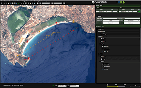
Scenario Definition and Pre-Mission Control Module
Supports the user in creating the “Range Abstraction Layer” a virtual model of :
- The launch site
- Launch platforms
- Rocket
- Sensor positions
- Environment and Metrological Information
- Terrain
Sensor Performance Analysis and Best Deployment
For each sensor, the application runs a simulation and computes the sensor coverage for the given mission and sensor configuration. Sensor coverage is overlaid on top of 3D terrain and topographical map.
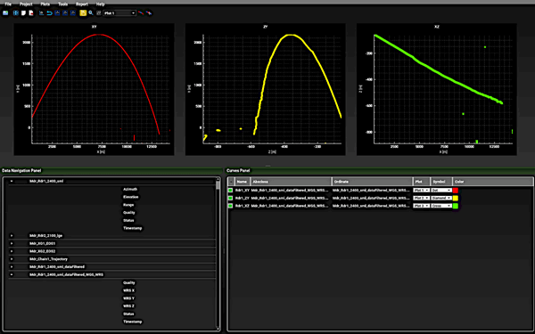
Range Safety Planning and Debris Impact Analysis Module
Two advanced modules used to manage pre/post safety operations for real-time missions. Given a debris pattern input for a Flight Vehicle, the modules will be able to produce a fragmentation ground pattern and a risk estimation for the entire ground area. The risk estimation can be performed during a real-time mission or in pre/post mission.
Test Data Post Processing Module
For use with multiple optical tracking systems, the advanced Test Data Post Processor (TDPP) is a set of post mission applications for the Best Estimate of Trajectory (BET) by combining various common range data sensors in a single solution.
2. Mission Control Applications
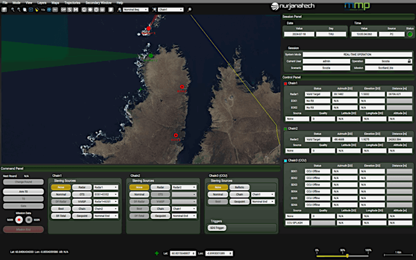
Multi Sensor Data Fusion Module
Different sensors provide different capabilities in terms of range and accuracy of track data received by the sensors.
The sensor fusion algorithms combine track data received from multiple sensors to improve accuracy of the trajectory estimate.
MSDF algorithms will produce the most accurate information on the status of the flight vehicle at any given point in time, in real-time.
Sensors Remote Control and Calibration Module
This module provides, through specific Application Programmable Interfaces, the capability for the configuration and calibration of optical trackers.
Scenario Assessment and Track Management Module
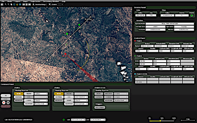
The Scenario Assessment Module provides the operator with the capability to monitor the real-time scenario in progress during the mission and make decisions based on their assessment of the situation.
Range Safety Decision Support System Module
The Range Safety Decision Support Module checks in real time that the flight is inside a predefined three-dimensional flight corridor (i.e. that the mission is progressing with no safety hazards) and raises alarms if the flight is detected as no longer safe.
Ballistic Predictor Module
Simulates In real-time the ballistics of debris in case of anomalies or termination in accordance with STANAG 4355. Calculations can be made in relation to weather: temperature, pressure, wind and humidity.
Video Tracking Module
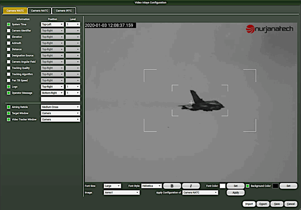
The video tracking module exploits several image processing algorithms to implement an EOS based system able to autonomously track either:
• A single designated target (launch vehicle, airplane, helicopter, missile, etc.)
• A cloud of targets generated by a separation or an explosion (missile from airplane, artillery explosion)
Additional modules are available for video tracking, the monitoring and control of drones, space surveillance and tracking, and environmental monitoring using satellite data.
Space Launch Solutions Product Menu : CMA Data Acquisition - SE-320 Camera - S-Band Transmitters - Ground Telemetry - Range Safety, Command & Control